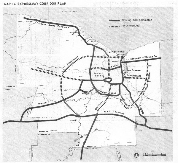
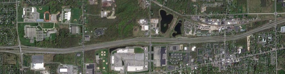
The Rochester area had a large number of cancelled corridors, which is most visible through the extra ramp from South Avenue to I-490 east, which was intended for I-390. There is also extra right of way between I-490 and Broadway that would have been used for I-390. The only corridors to be built on the map above which were not marked as "existing and committed" are parts of the Genesee Expressway (I-390) and Relocated Route 31 (NY 531). The image above shows the existing and recommended freeway/expressway system in Monroe County in 1969, from the Rochester Metropolitan Transportation Study 1990 Transportation Plan.
Additionally, the freeway and expressway system around Rochester has a rich history, having seen many changes over the years and decades. Changes related to the Inner Loop are on Inner Loop and the the Outer Loop freeway are on the associated articles; everything else is depicted here. The images below have been obtained from the U.S. Geological Survey (USGS) Eros Archive and Google Earth.
Contents
- Interstate 90/New York State Thruway
- Interstate 390/Genesee Expressway
- Interstate 490
- NY 104
- NY 204/Airport Expressway
- NY 531/Spencerport Expressway
- Lake Ontario State Parkway
Interstate 90/New York State Thruway
The Thruway between Victor and Farmington was one of the first sections to open, originally on a toll-free basis. NY 332 was also long a two-lane road through farm country. Construction on the modern divided highway was completed in 2002, and the Towns of Farmington and Canandaigua have both developed rapidly. The images above are from 1951 (top, USGS), 1994 (middle, Google/U.S. Geological Survey), and 2013 (bottom, Google).

Exit 45 was originally constructed as three quarters of a cloverleaf interchange; it was modified into a trumpet with NY 96 when the Thruway became a toll road. The images above are from 1951 (top, USGS) and 1959 (bottom, USGS).
Exit 45 was modified again when I-490 was built. The I-490 interchange with NY 96 later saw the addition of the ramp from NY 96 south to I-490 west as part of a reconstruction project around 2002. The images above are from 1994 (top, Google/USDA/FPAC/GEO) and 2011 (bottom, Google).
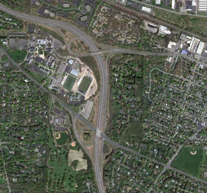
Exit 46 was originally with NY 15 and was modified upon the completion of I-390 in the area in 1980. The remainder of the original interchange is still used as the Henrietta Maintenance Section. The images above are from 1972 (top, USGS), and 2011 (bottom, Google).
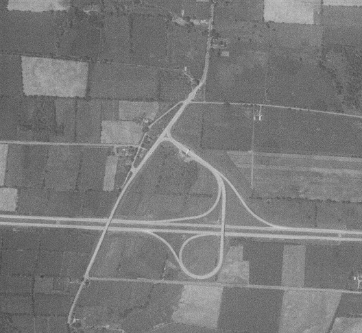
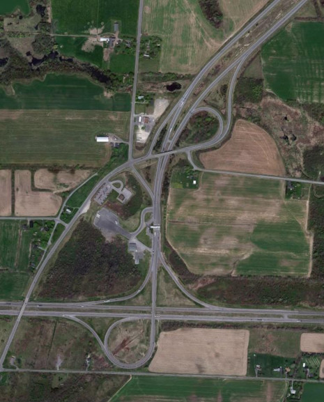
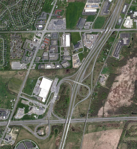
Exit 47 was first constructed with NY 19 and modified in 1965 when I-490 was built to the Thruway. The images above are from 1958 (top, USGS) and 2011 (bottom, Google).
Interstate 390/Genesee Expressway
The interchange for Hylan Drive was originally a diamond interchange and modified to remove the left turn for traffic from Marketplace Mall heading to I-390 north. The images above are from 1994 (top, Google/New York GIS) and 2013 (bottom, Google).
The ramp from I-390 south to Brighton-Henrietta Town Line Road was built in 2006 to improve access to Monroe Community College. The image above is from 2013 (Google).
Interstate 490
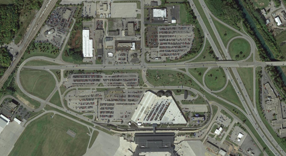
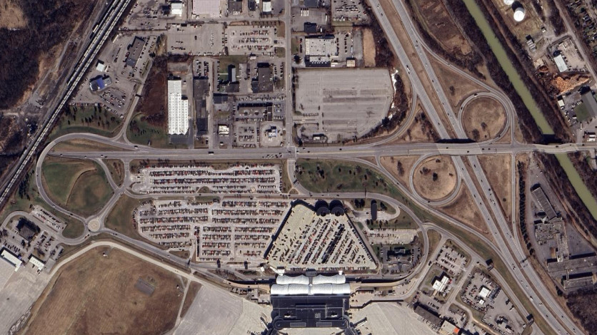
The interchange with Ames Street and Child Street was modified to separate the westbound ramps around 2008 as part of a reconstruction project. The images above are from 2002 (top, Google/New York GIS) and 2021 (bottom, Google).
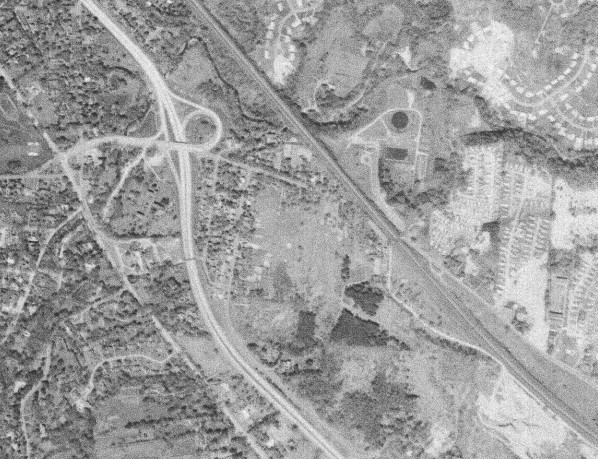
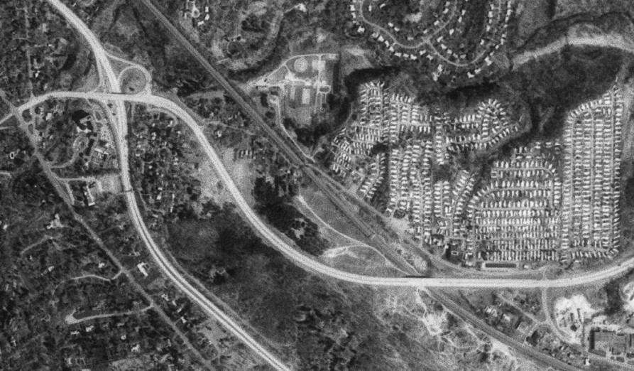
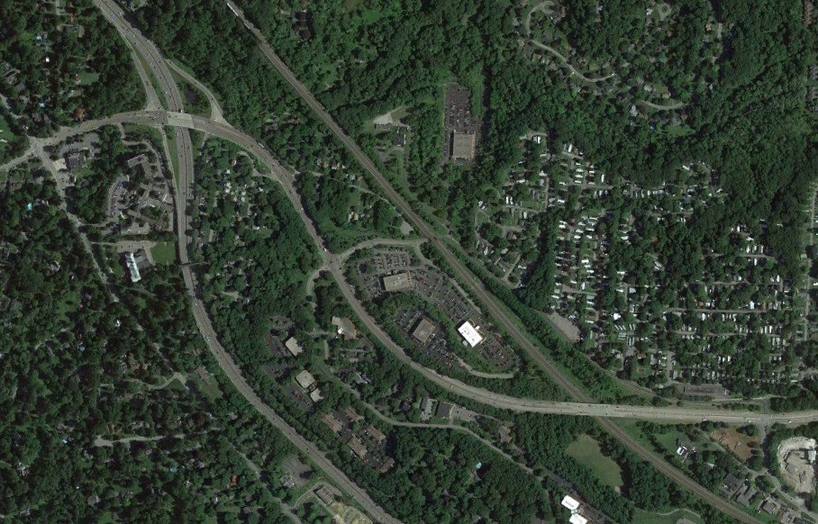
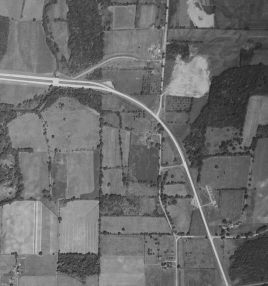
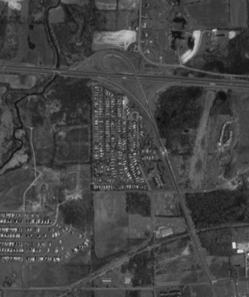
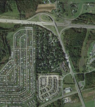
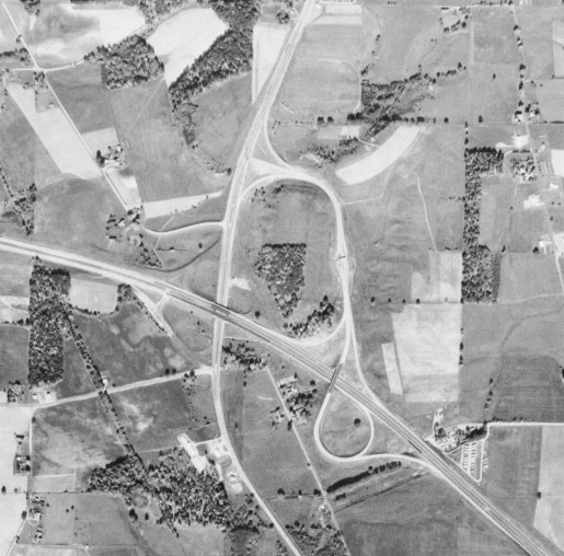
The NY 441 interchange has been modified multiple times. It was originally a trumpet with NY 96 before being incorporated into the NY 441 divided highway in 1971. It was modified again in the 1990s as part of a bridge replacement project; Linded Avenue was later realigned to reduce the curves near the railroad bridge. The images above are from 1960 (top, USGS), 1981 (middle, USGS), and 2015 (bottom, Google).
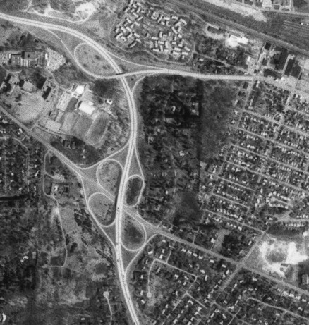
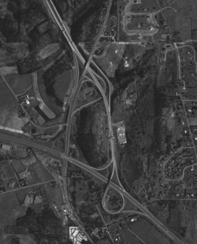
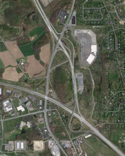
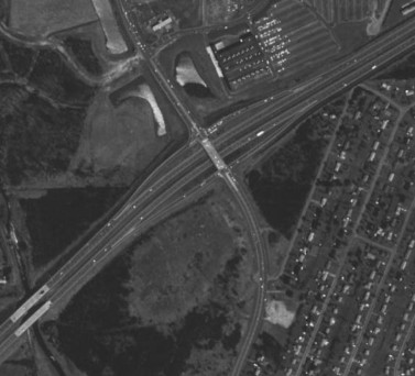
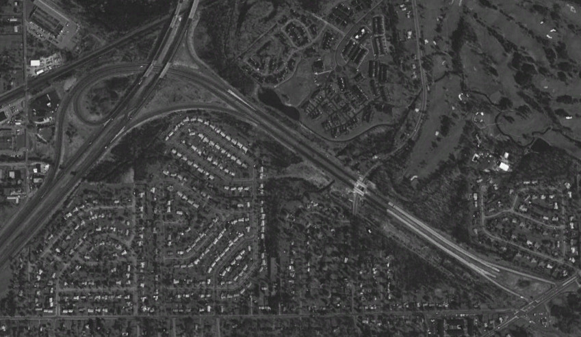
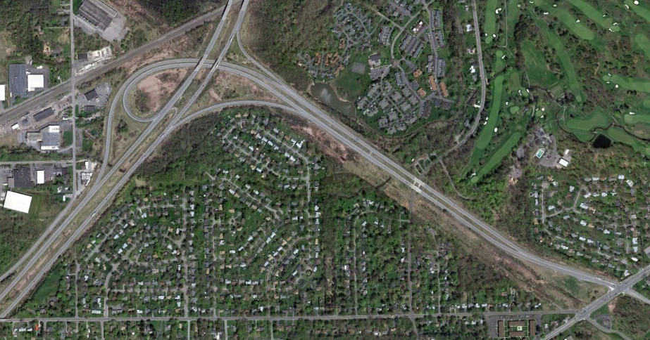
The NY 31F interchange was originally a cloverleaf interchange and was reconfigured in the 1980s or early 1990s to remove most of the loop ramps, reducing weaving westbound with the East Rochester interchange. The images above are from 1981 (top, USGS) and 2011 (bottom, Google).
NY 104

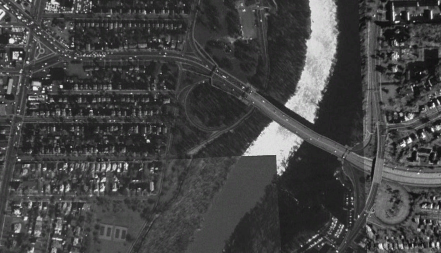

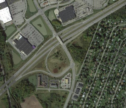
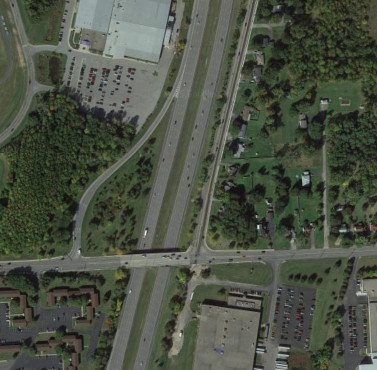
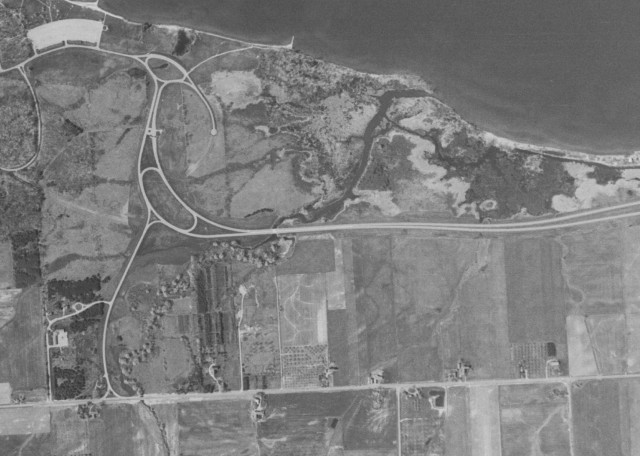
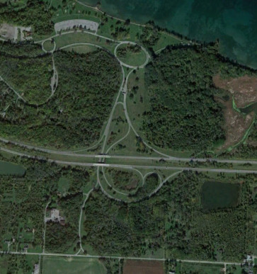
The Veterans Memorial Bridge carries NY 104 (formerly US 104) across the Genesee River and originally connected with a traffic circle on the eastern side. The traffic circle was eliminated with the construction of the Keeler Street Expressway in 1969. The section to the west was realigned in 2005 after a row of houses burned down, allowing for the expressway to end at a traffic light rather than residential driveways. The freeway was originally planned to continue to I-390, however the western portion was not built. The images above are from 1960 (top, USGS), 1994 (middle, Google/U.S. Geological Survey), and 2016 (bottom, Google).
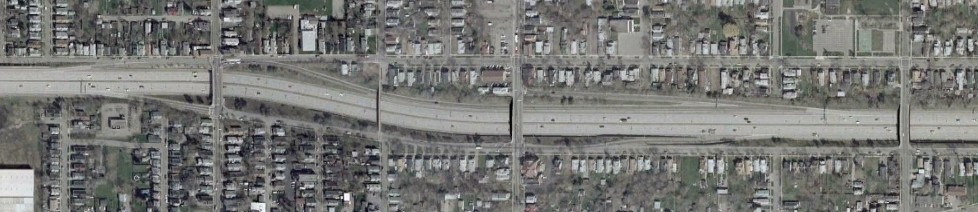
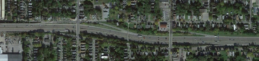
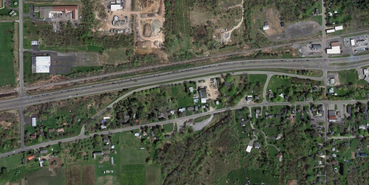
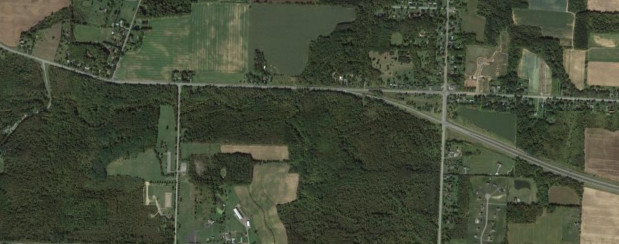
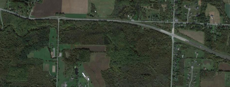
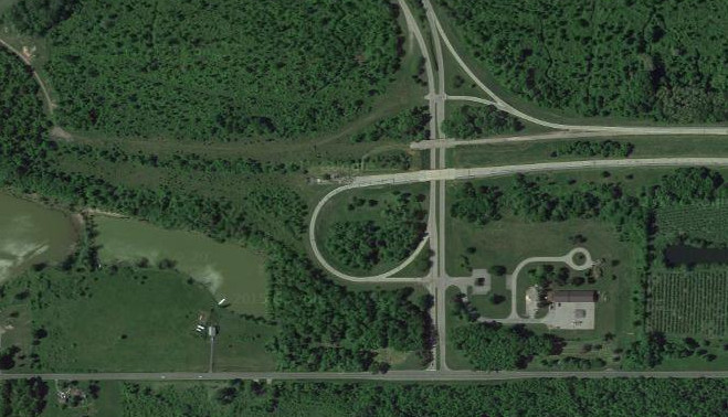
The US 104 freeway was extended to Five Mile Line Road in 1970 and redesignated as NY 104 in 1971. The frontage roads in Webster opened in 1977 and the full freeway wasn't completed until 1985. The images above are from 1972 (top, USGS), 1981 (middle, USGS), and 2011 (bottom, Google).

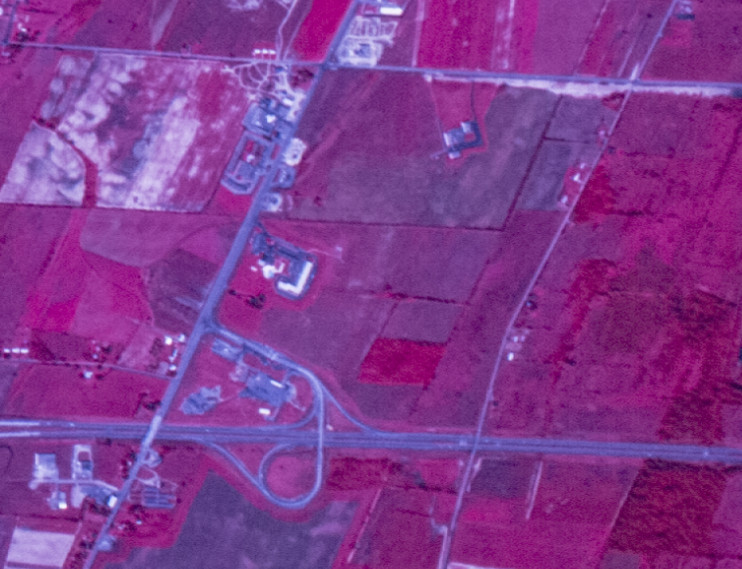
The modern alignment of NY 104 in Wayne County was built before the freeway and divided highway in Monroe County was finished. Prior to the connecting piece being opened in 1977, NY 104 followed a connector to Ridge Road (now the east end of NY 404). The images above are from 1972 (top, USGS) and 2011 (bottom, Google).
NY 204/Airport Expressway
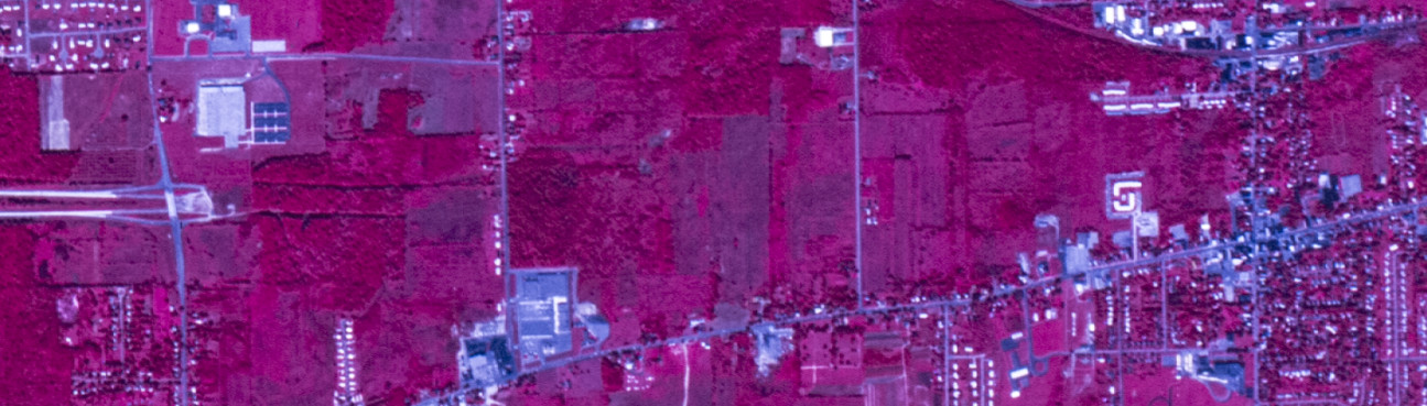
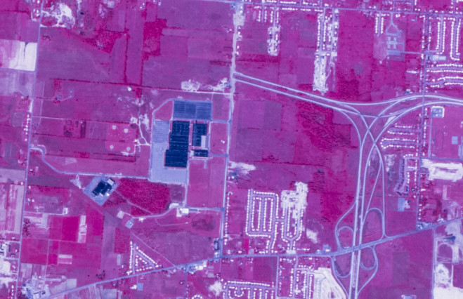
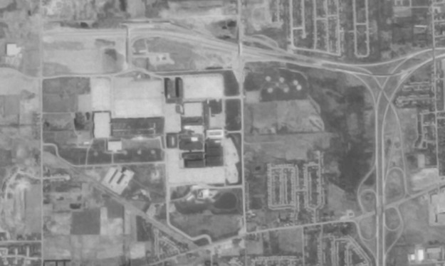
NY 204 was intended to follow the Airport Expressway from I-490 to I-390 near the airport. Only the portion from I-490 to NY 33A was constructed; the remainder was cancelled around 1980 due to resident opposition and NY 204 follows NY 33A and Brooks Avenue to I-390. The stub with NY 33A was eliminated in 2001. The images above are from 1994 (top, Google/U.S. Geological Survey) and 2011 (bottom, Google).

Although the Airport Expressway was never completed, the area around the airport has seen modification as the airport has expanded. A flyover was built for traffic from Rochester to get to the airport, and the roads within the airport have been reconfigured as well. The images above are from 1972 (top, USGS), 2013 (middle, Google), and 2025 (bottom, Google/Airbus).
NY 531/Spencerport Expressway

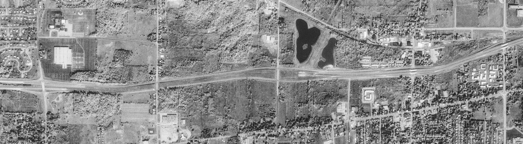
What is now NY 531 was originally concieved as part of plan to link Rochester and Buffalo with a toll-free highway (connecting to I-990). The first segment of the expressway (known in Rochester as the Spencerport Expressway) was opened in 1963 and was reference route 940P. The NY 531 designation was added in 1985 with the extension to Manitou Road. NY 531 was extended to NY 36 in 1994. The images above are from 1972 (top, USGS), 1986 (middle, USGS), and 2013 (bottom, Google).
The NY 531 freeway was planned to extend west from NY 36 to Brockport, however these plans were cancelled and instead a project to improve NY 31 was constucted around 2018. This project provided direct access from NY 531 west to NY 31 west and improved NY 31 west to NY 260. The images above are from 2013 (top, Google) and 2023 (bottom, Google).
Lake Ontario State Parkway
The Lake Ontario State Parkway extends from Lakeside Beach State Park off NY 18 to Lake Avenue in Rochester. The western end is a stub as the Parkway was originally supposed to extend west and connect with the Robert Moses State Parkway (now the Niagara Scenic Parkway) near Fort Niagara. The extension in unlikely to be constructed, especially as the Parkway has been closed west of NY 98 in winter since 2012 due to low traffic volumes (only 800 vehicles per day in the summer). The image above is from 2015 (Google).
The original western end of the Parkway was at Hamlin Beach State Park, with the extension to Lakeside Beach State Park opening in 1973. The images above are from 1960 (top, USGS) and 2021 (bottom, Google).
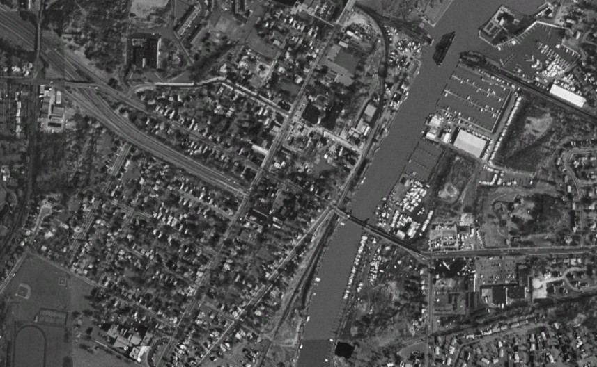
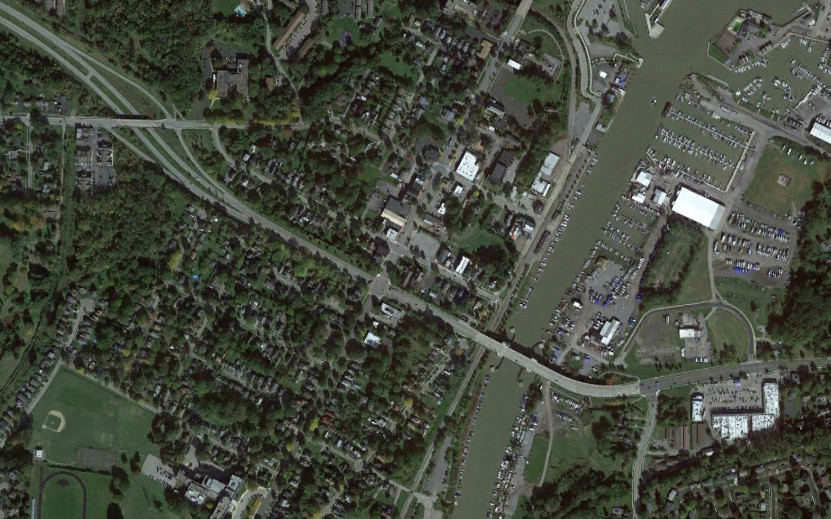
The eastern end of the Parkway was reconfigured around 2004 as part of the project to replace the Stutson Street Bridge with the Colonel Patrick O'Rorke Memorial Bridge, allowing traffic to flow directly from the Parkway to Pattonwood Drive in Irondequoit without making a couple of turns onto Stutson Street via Lake Avenue. The images above are from 1994 (top, Google/U.S. Geological Survey) and 2021 (bottom, Google).