
Like other cities in New York, Syracuse has a number of cancelled freeway and expressway corridors. The NY 5 freeway would have extended in both directions; on the west, it would have connected to the Auburn arterial system, and on the east, it would have bypassed Syracuse to end at I-81 at the southern city line, north of the US 11 interchange in Nedrow. There was also a plan for a freeway extending I-690 all the way to Chittenango; later, a smaller scale project for a four-lane facility to the NY 290/NY 257 intersection in Manilus Center was also evaluated. Additionally, John Glenn Boulevard would have been extended north to NY 481. West Street would have also extended east to I-81 as an arterial "inner loop". The image above is a map from an early 1970s transporation plan that Adam Froehlig found in the library at Syracuse University.
The freeway and expressway system has evolved over the years, particularly around I-690 and I-81. Changes releated to the I-81 viaduct removal project are on the associated article; everything else is depicted here. The images below have been obtained from the U.S. Geological Survey (USGS) Eros Archive and Google Earth.
Contents
- Interstate 81/Business Loop 81
- Interstate 90/New York State Thruway
- Interstate 481 (new Interstate 81)/NY 481
- Interstate 690/NY 690
- NY 5
- John Glenn Boulevard
Interstate 81/Business Loop 81
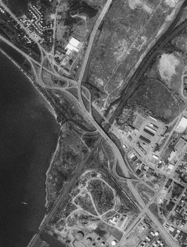
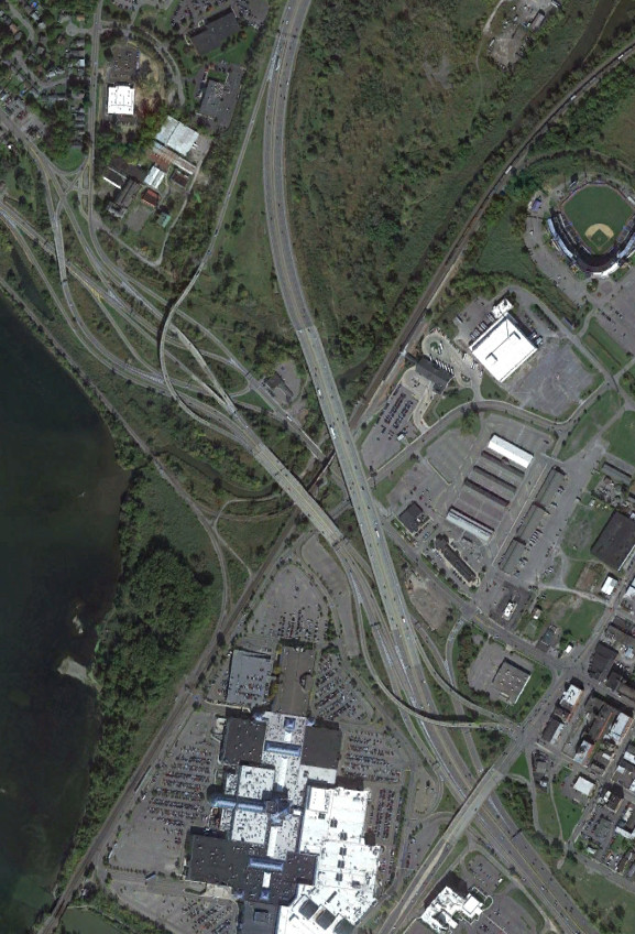
The original alignment of I-81 was repurposed for the ramps to NY 370 (the Onondaga Lake Parkway) and Old Liverpool Road, with a new alignment constructed to the east. This had the effect of merging historic exits 23 and 24 (and southbound 22) into a single interchange. The images above are from 1981 (top, USGS) and 2019 (bottom, Google).
Exit 36 of the Thruway originally met with an arterial highway splitting off from US 11, which was later upgraded into I-81. The images above are from 1957 (top, USGS) and 2017 (bottom, Google).
The old arterial intersection with US 11 was incorporated into the interchange with US 11 when I-81 was built. The image above is from 2017 (Google).
Interstate 90/New York State Thruway
The Thruway was originally planned as a free facility before tolls were added to accelerate construction. Some construction had been completed prior to the decision to toll the Thruway, with exit 38 being among that. The original westbound ramps were still visible for a long time, but now little evidence of them remains. The images above are from 1957 (top, USGS) and 2019 (bottom, Google).
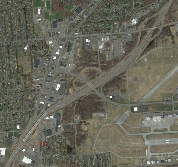
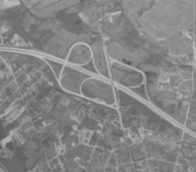
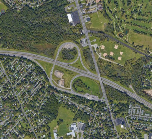
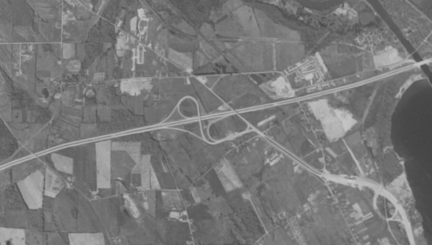
Interstate 481 (new Interstate 81)/NY 481
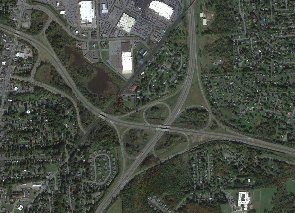
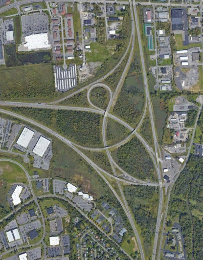
The interchange between I-81 and NY 481 was initially a trumpet interchange before becoming a cloverleaf when I-481 was completed. Construction began in 2024 to further reconfigure the interchange as part of the I-81 viaduct removal project. The images above are from 1981 (top, USGS) and 2019 (bottom, Google).
Interstate 690/NY 690
Exit 39 of the Thruway originally connected with NY 48, which was truncated when I-690 was built. The exit was not moved at that time, with a traffic light between what is now exits 8 and 9 and other at-grade intersections nearby. The modern exit 39 opened in 1987, extending I-690 and brining this section up to freeway standards. The images above are from 1957 (top, USGS), 1981 (middle, USGS), and 2017 (bottom, Google).

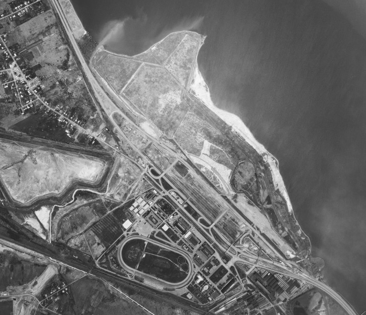
Prior to the opening of NY 695 in 1977, I-690 (and before it, NY 48) had a completely different configuration through the State Fair. The images above are from 1957 (top, USGS) and 1972 (bottom, USGS).
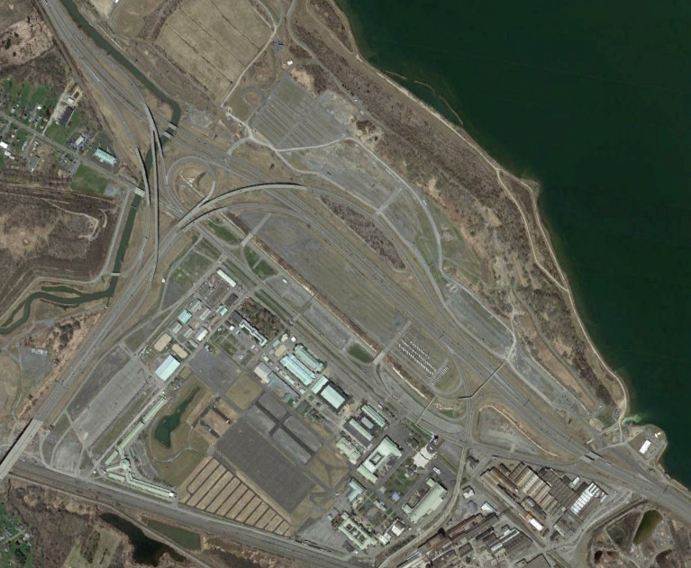
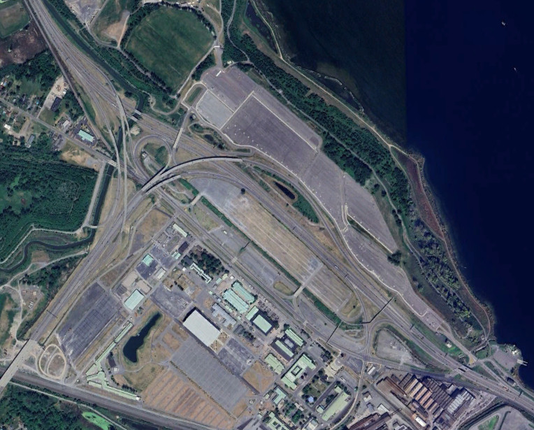
I-690 used to have a traffic light for 12 days each year during the State Fair to facilitate access from one of the parking lots. Construction of the ramps necessary to eliminate the traffic light finished in 2020. The images above are from 2017 (top, Google) and 2024 (bottom, Google/Airbus).
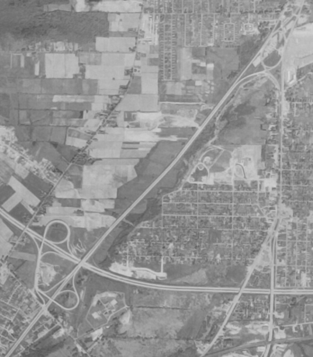
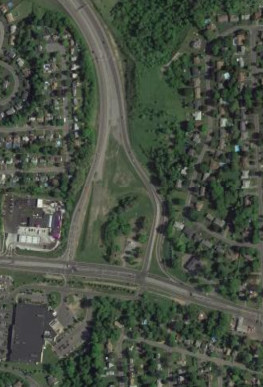
The I-690 freeway was planned to extend east to Chittenango. These plans were later scaled down to Manlius before being cancelled entirely, with the planned freeway mainline now being used to access a NYSDOT maintenance site. The image above is from 2015 (Google).
NY 5
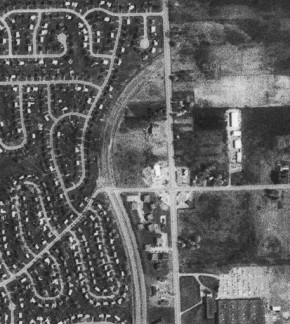
Both ends of the NY 5 freeway have stubs showing planned expansion. To the west, the freeway would have extended to Auburn and connected to the arterial highway there. The image above is from 2015 (Google).
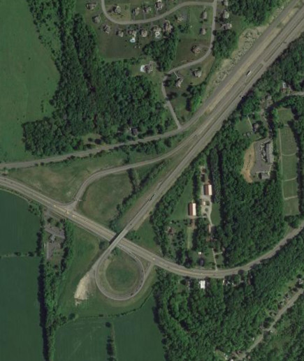
To the east, the freeway had multiple paths, both as a relocation of NY 5 to downtown and a southwestern bypass to I-81. The image above is from 2015 (Google).
John Glenn Boulevard
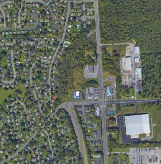
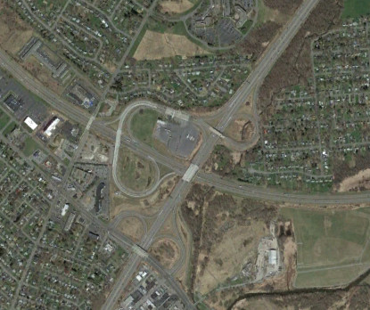
John Glenn was planned to extend north to NY 481, but only opened as far as Buckley Road. Construction had begun to extend it to Morgan Road, however this is not very visible today. The images above are from 1981 (top, USGS) and 2019 (bottom, Google).